The Unforgiving Horn
At 11:56 a.m. on April 25, 2015, the ground beneath Nepal shook. The magnitude 7.8 earthquake, centered 82 kilometers northwest of Kathmandu, released decades of pent-up energy.1The capital was in chaos. Ancient temples and palaces that had survived centuries collapsed in seconds. The famous Bhimsen Tower, the symbol of the city, was reduced to rubble, burying dozens of people.2Across the country, homes collapsed, roads cracked, and communications with the outside world were cut off. When the dust settled, the horrific scale of the tragedy became clear: more than 8,600 dead and over 22,000 injured in Nepal alone.1It was the most destructive earthquake in the country in the last 80 years.4
But for Nepal, seismic activity is only one side of the coin. Every year with the arrival of the monsoons, the country faces another, equally insidious threat: floods and landslides. Torrential rains that lash the Himalayas transform peaceful rivers into raging torrents that sweep away everything in their path. In 2024, for example, the country experienced the heaviest rains in 50 years, killing hundreds.5This dual vulnerability is not just bad luck. It is written into Nepal’s geography. The country is located on the collision zone of the Indian and Eurasian tectonic plates, making it one of the most seismically active regions in the world.7At the same time, its mountainous terrain and climate create ideal conditions for hydrological disasters, which account for almost half of all natural disasters over the past half century.8
This stark reality would have broken any nation. But in Nepal, it has become a furnace in which resilience is forged and innovation is born. Faced with existential threats, a new generation of Nepalese engineers, scientists, and ordinary citizens have refused to be passive victims. They have realized that a national trauma like the 2015 earthquake should not be an end, but a beginning – a powerful catalyst that has transformed the country’s approach to risk management.10This push accelerated research, forced a rethinking of building codes, and generated the political will to create ambitious defense systems. Today, Nepal is fighting the elements with a unique combination of cutting-edge technology and the centuries-old wisdom of its communities, creating and implementing ingenious early warning systems that are already saving thousands of lives.
Taming Rivers – The Power of a Phone Call and Community
The success story of Nepal’s flood warning system is a tale of how a complex challenge can be met by relying not only on technology but also on people. This proven model has become the foundation and inspiration for all other risk management efforts in the country.

The relentless waters of the Terai
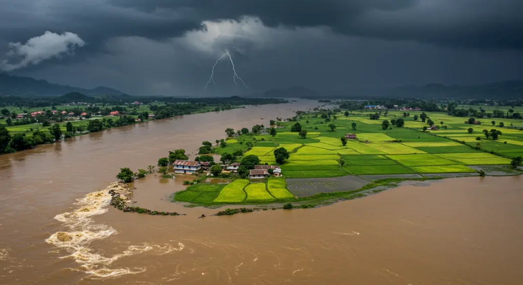
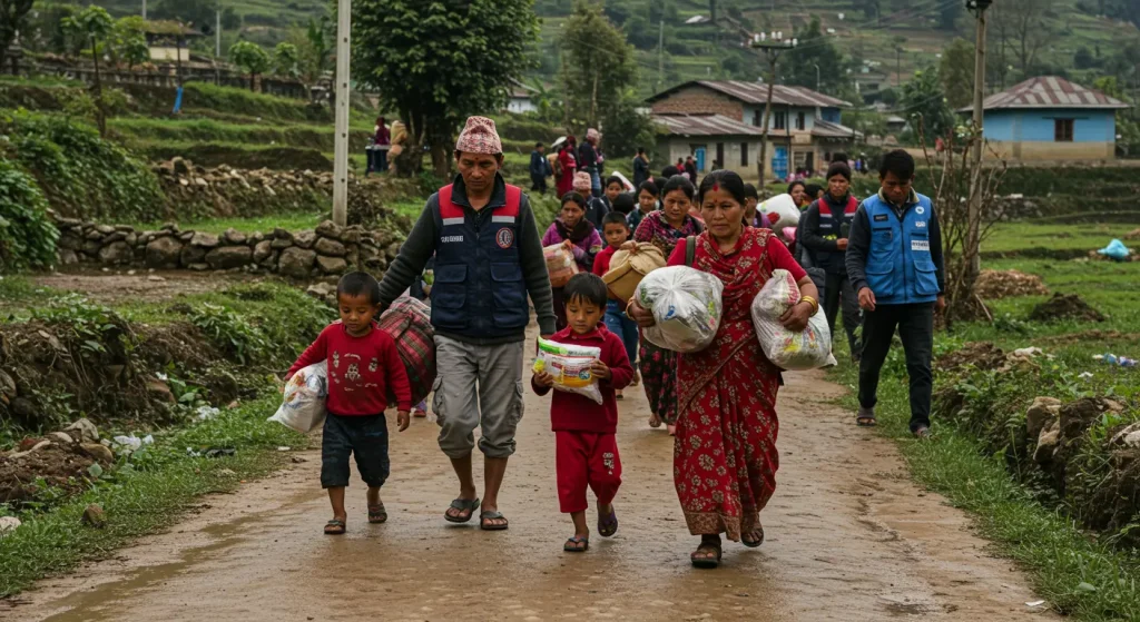
Every year, monsoon rains wreak havoc in the Terai, the fertile plains in southern Nepal. Rivers that originate in the Himalayas, such as the Kosi, Narayani and West Rapti, overflow their banks, causing sudden and devastating floods.11These floods destroy crops, destroy homes and claim lives every year, with the most vulnerable rural communities suffering the most, often without the resources to protect themselves or information about the impending threat.13
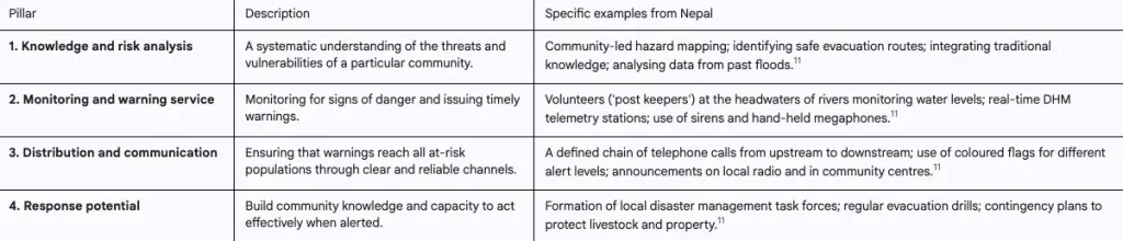
It is to protect these people that the Community-Based Flood Early Warning System (CBFEWS) was developed. Its philosophy is simple but revolutionary: it is a “people-centric” system that does not simply impose a technological solution from above, but puts power and tools in the hands of the residents themselves.11Its success is rooted in a bottom-up approach that recognizes that the most effective solutions come from the local level.15
The Anatomy of a Warning: How It Works
The CBFEWS system is an elegant combination of high technology and human involvement.
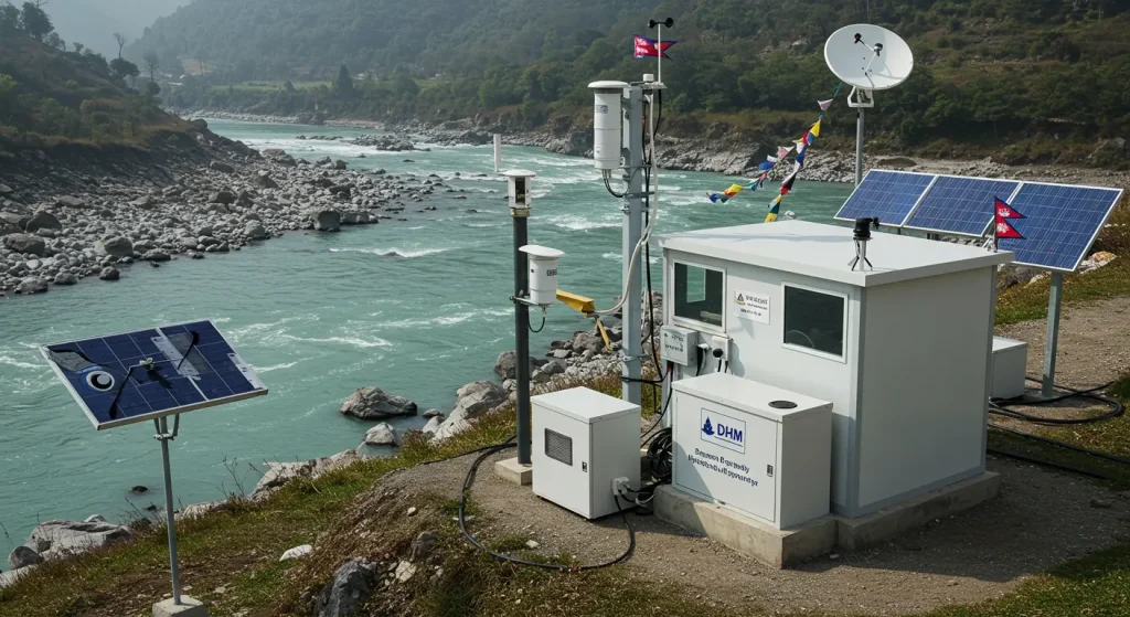
National backbone: The technological backbone is Nepal’s Department of Hydrology and Meteorology (DHM). It operates a national network of hydrological and meteorological stations, many of which are equipped with modern technology. For example, the Narayani River basin has a real-time telemetry system that uses CDMA modems to transmit water level and rainfall data to a central server in Kathmandu. This data is available online at www.hydrology.gov.np, creating a robust information backbone for the entire country.11
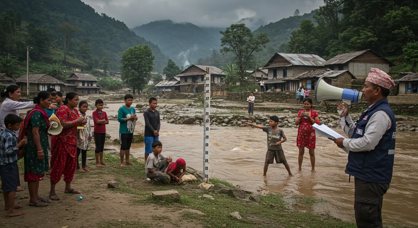
Network of “human sensors”: But the real magic of the system happens on the ground. In the villages located in the upper reaches of the rivers, volunteers work – “post keepers”. Their tools are simple: these can be ordinary poles with colored marks, installed directly in the river.11These people are the eyes and ears of the entire system.
Communication chain: When the caretaker notices that the water has reached a dangerous level, a well-oiled chain of actions is launched.
- Observation: A caretaker at the headwaters of the river records a critical rise in the water level.
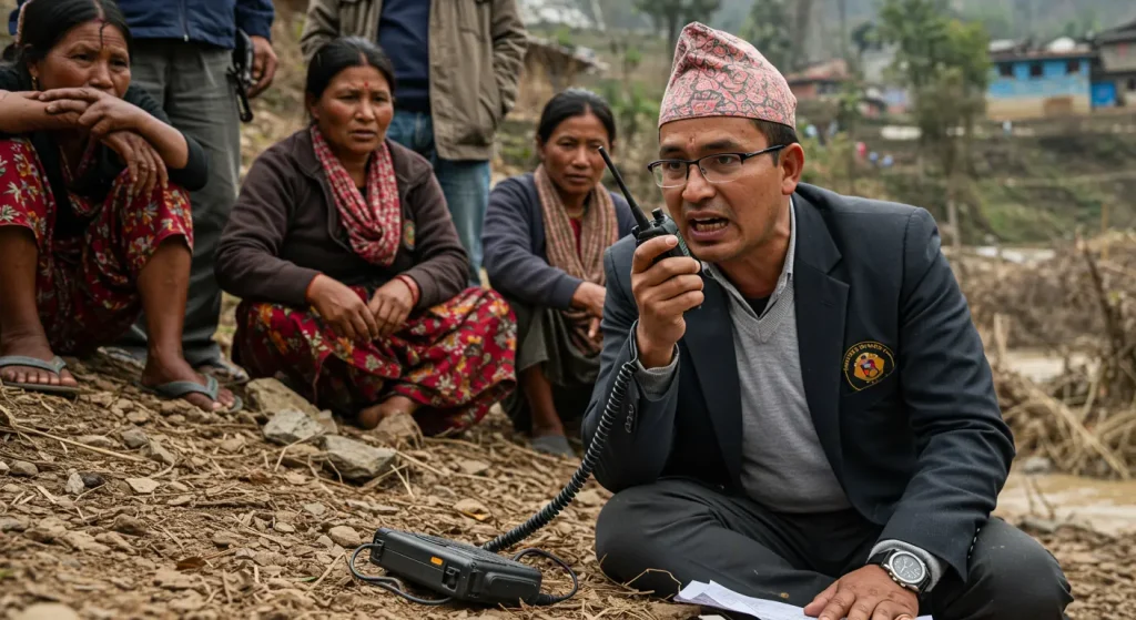
- Alert: He immediately calls on his mobile phone or VHF radio to contact the disaster management task force contact in the village downstream.
- Alarm: Once the signal is received, the local group activates the warning system: turning on sirens, using hand-held megaphones, or even making announcements over loudspeakers in mosques and temples.11
This simple yet incredibly effective chain gives lowlanders their most valuable asset in times of danger – time. The feedback from the people speaks for itself. Kamata Prasad Morya, task force coordinator in Gangapur village, says, “We feel safer because of our early warning system. We got the news of the flood six hours before it arrived from the Kusum post, and we had enough time to evacuate to a safe shelter.”11These 5-6 hours are not just numbers. These are saved lives, saved livestock, and documents and seeds protected from water.11The system’s effectiveness has also been confirmed at the international level: in one case, a warning transmitted from a post on the Ratu River in Nepal allowed villagers in neighbouring India to evacuate in time, demonstrating the potential for cross-border cooperation.18
Ecosystem of collaboration
The success of CBFEWS would not have been possible without a unique ecosystem of collaboration. This is not just a government project. It is the result of partnerships between government agencies like DHM, international organizations including the International Centre for Integrated Mountain Development (ICIMOD) and the World Meteorological Organization (WMO), non-governmental organizations like Oxfam, Mercy Corps and Practical Action, and, most importantly, local communities themselves and their disaster management committees.11
It’s this approach that has helped solve the so-called “last mile problem” of disaster warnings. Many systems around the world excel at forecasting but fail at the last step – delivering the warning to a specific person in a remote village. The Nepali model addresses this by making the community itself the heart of the system. Technology such as telemetry is a powerful tool, but the soul of the system is the trust between upstream and downstream villages, the local committees that conduct drills, and the simple phone call that saves lives.15
Push Race – Seconds of Warning
If flood warning is a story of finely honed craftsmanship, then fighting earthquakes is a new, more ambitious and technologically sophisticated frontier. Here, seconds, not hours, count, and the cost of error is immeasurably higher.
Ghost of Gorkha (again)
It was the specter of the 2015 earthquake that became the driving force behind innovation in this area. National trauma created a pressing need for a system that could provide at least a few precious seconds of head start. That brief window of time might be enough for people to duck under a table, or for a train to automatically stop, or for a complex surgical procedure to be interrupted.1
The Science of Split-Second Warning
The Earthquake Early Warning System (EEWS) is based on the fundamental laws of physics. An earthquake produces two types of seismic waves: fast but relatively harmless P-waves (primary) and slower but extremely destructive S-waves (secondary). The idea behind the EEWS is for a network of sensitive seismometers to detect the arrival of the P-waves and instantly transmit an alarm signal. Because the electronic signal travels at the speed of light, it outpaces the slow S-waves, giving people in the area a vital window of seconds to a minute.23
Local Minds, Global Collaboration: The Rise of Nepali Expertise
Nepalese scientific and educational institutions are at the forefront of this technological race. Key roles are played by the Tribhuvan University Institute of Engineering (IOE) and the National Seismological Centre (NSC), which have become local centres of excellence in this field.22
Recognizing the complexity of the task, they actively build partnerships with leading global centers. One of the most striking examples is the collaboration with Duke University (USA) and the international organization Geophysics Without Borders (GWB). This synergy has proven extremely fruitful. As James Marek, a participant in the project from Duke University, notes, the team from IOE provides invaluable “inside views and an inimitable understanding of the needs of the community,” while international partners bring additional research capacity and resources.24This is not just a technology transfer – it is a co-creation in which Nepalese engineers and scientists act as equal leaders.
Technology of Hope: Democratic and Scalable Solutions
One of the most notable features of Nepal’s approach to EEWS is its choice of technology. Rather than relying on expensive proprietary equipment that is often unaffordable in developing countries, Nepal is opting for open-source, scalable and democratic solutions.
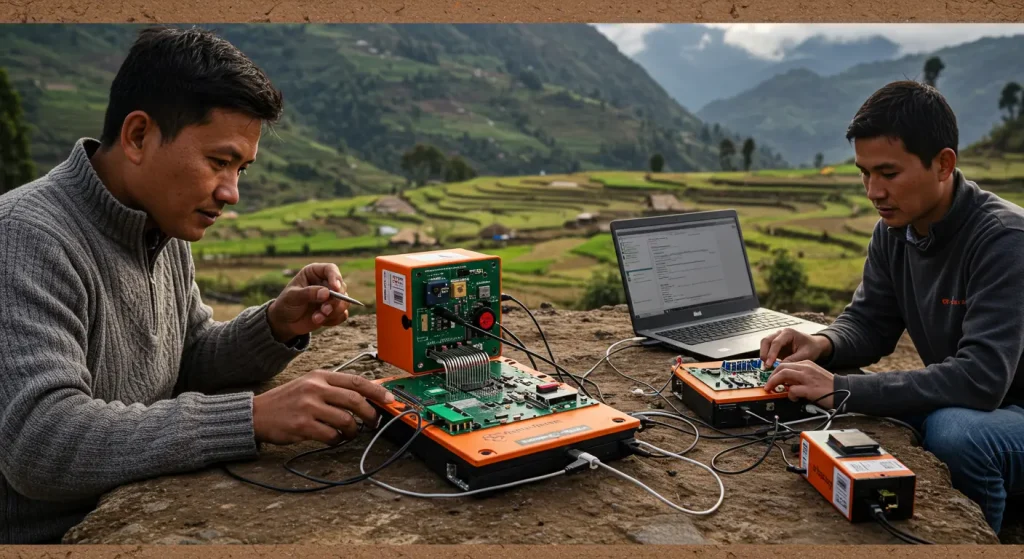
In particular, the country is testing an innovative combination of inexpensive personal seismometers «Raspberry Shake» and open source platforms OpenEEW (Open Earthquake Early Warning).24The Raspberry Shake is an affordable device that even a small organization or school can afford, opening the way to a dense and extensive surveillance network. The OpenEEW platform, in turn, provides software for collecting and analyzing data from these sensors in real time. This strategic choice allows for a system that is not only cheaper, but also more flexible and adaptable to local conditions.
However, the road to a full-scale national EEWS system is fraught with challenges. The project is currently still in the pilot testing phase.27There are significant hurdles, most notably financial ones. For example, a proposal to allocate an initial budget of $1.5 million to deploy the first 76 sensors has encountered bureaucratic delays.28In addition, there is the enormous logistical challenge of deploying and maintaining thousands of sensors across the country’s mountainous terrain.
But the biggest challenge lies beyond technology and finance. Flood warning systems were built from the bottom up, with many hours of lead time and community involvement. Earthquake warning systems are vertical in nature, starting with a network of sensors and pushing information down. This creates a new, much more complex “last mile problem.” While floods were solved with a phone call, earthquakes, where every second counts, require instant, automated delivery of a signal to millions of mobile devices. And the big question Nepalese innovators are trying to solve is not technical but behavioral: how to educate a population of 25 million28respond to an alarm immediately and correctly without causing panic and chaos?
Conclusion: Building a Sustainable Future, One Warning at a Time
Nepal’s history of disaster management is a tale of two different but complementary systems. Rather than following a single path to security, the country has pursued a dual strategy. On the one hand, it has perfected a community-based model for dealing with predictable and relatively slow-moving disasters like floods. On the other, it has boldly embraced advanced technology to deal with immediate and unpredictable threats like earthquakes.
Nepal’s true innovation is not in any single technology, whether sensor or software. Its greatest achievement is creating a hybrid resilience model that values both the traditional wisdom of the village chief and the sophisticated algorithms of the seismologist. Nepal has learned that technology is just a tool. Its true power is only revealed when it is put into the hands of a prepared and cohesive community.
Forced to live on the edge, Nepal has become a living laboratory for 21st-century disaster risk reduction. The lessons being learned today in the Himalayan foothills – about combining low-cost technology with deep human engagement, about building effective local-global partnerships, and about the relentless drive to save every life – offer a powerful and inspiring example for other vulnerable nations around the world.21
Source used
- Earthquakes in Nepal (2015)
- Destructive earthquake in Nepal – Bulletin of the Earth Sciences of the Russian Academy of Sciences
- Results of the destructive earthquake in Nepal – Bulletin of the Earth Observatory of the Russian Academy of Sciences
- Earthquake aftermath in Nepal – Interfax
- Nepal experiences heaviest rainfall in 50 years. Floods kill over 100 people Photos – Meduza
- Floods in Nepal have killed about 150 people, and the country’s capital, Kathmandu, has been flooded. | Tajikistan News ASIA-Plus
- The most seismic regions of the world: analysis | Azerbaijan News | Media.az
- ATLAS OF MORTALITY AND ECONOMIC LOSSES DUE TO EXTREME EVENTS – UN CC:Learn
- landscape characteristics and cultural processes in the siwalik hills: a geographical perspective – ResearchGate
- New Probabilistic Seismic Hazard Model for Nepal Himalayas by Integrating Distributed Seismicity and Major Thrust Faults – MDPI
- (PDF) Community based flood early warning system in Nepal
- Real-Time Flood Data and Science Products Support Flood Monitoring in Nepal – ICIMOD
- Disaster Risk Reduction in Central Asia – PreventionWeb.net
- Floods – BeSafeNet
- Early warning systems based on … – PreventionWeb.net
- Early Warning Systems and Mitigation Measures – ICIMOD
- In Search of More Time – ICIMOD
- How early warning systems helped get funds for Nepal’s flood-prone Terai region
- establishment of community based early warning Systems – PreventionWeb.net
- Oxfam in Nepal and ICIMOD join hands with communities to manage flood risk in Nepal
- Proceedings: Third World Conference on Disaster Risk Reduction, 14
- Experience of Earthquake Risk Management, Preparedness and Reconstruction in Nepal – NSET
- Fake. It is impossible to predict an earthquake – Factcheck.kg
- Together Around the World: Bass Connections Teams Continue to Engage Globally Despite Pandemic
- RISK2RESILIENCE | Convener’s Report – NSET
- fdsn.org
- From Timor Leste to Guatemala, How Early Warning Systems (EWS …
- Nepal Earthquake Early Warning System VP | PDF | Economies | Business – Scribd